Trails and Hiking
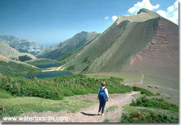
Carthew Lakes
|
Back country travel can be an
incredible experience whether on bicycle,
horseback or foot.
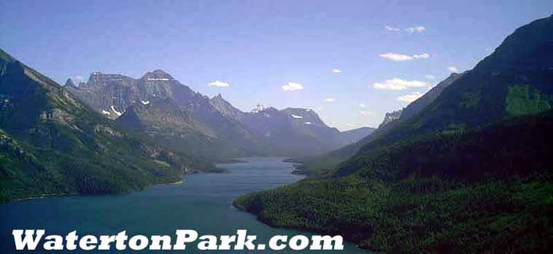
Waterton Park boasts world class hiking with
incredible scenery and many opportunities to
view wildlife. There are 255 km (191 miles) of trails in
Waterton Lakes National Park. They range in
difficulty from a short strolls to steep
treks of several days duration. A variety of
people make use of them, including hikers,
horse riders and bicyclists. Trails in
Waterton Park also lead to extensive trail
systems in Montana's
Glacier National Park and in British
Columbia's Akamina-Kishenina Provincial Park.
|
Basic Trail Safety
Waterton Lakes National Park offers a unique brand of
challenges - not only in daring, but also certainly in
judgment. Be smart! Keep the summer filled with excitement,
and follow these guidelines when hiking:
- Be sure to hike with someone else,
or even better, with a group.
- Let someone know your route and
expected time of return.
- Try to prevent a potentially
dangerous close encounter with
large animals (like bears) - make
noise! Every so often - especially
when visibility is blocked by
hills, trees, rocks, etc. - hoot
and holler or clap hands loudly. In
the presence of high winds or
streams, make your noise-making
efforts all the more intense.
- Be prepared! Have enough food,
water, clothes, rain gear and
coverings (e.g. space blanket) for
an unexpected overnight in the
backcountry.
- Use extreme caution around slippery
rocks, especially at waterfalls.
Learn how to cross unbridged stream
and river crossings safely.
- Carry good drinking water with you,
or boil "wild water" in
order to kill parasites and other
germs that may inhabit the park's
water.
- If you are camping overnight, you
must have a backcountry
camping permit.
- Become familiar with the national Leave
No Trace program. In brief,
whatever you pack in to the
backcountry, you must pack out.
|
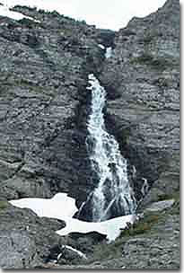
Waterfall near Alderson Lake
|
| Length |
Trail |
Trailhead |
Distance
(return) |
Time
(return) |
Elevation
Gain |
| Short Hikes and Strolls |
Townsite |
Townsite loop |
3.2 km loop
(2 mi) |
1 hour |
minimal |
|
|
Emerald Bay Loop |
Townsite |
4 km loop
(2.4 mi) |
1.5 hours |
minimal |
| Prince of Wales |
Emerald Bay |
2.0 km loop
(1.2 mi) |
45 minutes |
minimal |
Linnet Lake
*barrier free access |
Dock area across from Warden Office |
1.0 km loop
(0.6 mi) |
20 minutes |
minimal |
| Cameron Lakeshore |
Cameron Lake |
3.2 km
(2 mi) |
1 hour |
minimal |
| Akamina Lake |
Cameron Lake |
1.0 km
(0.6 mi) |
30 minutes |
minimal |
Red Rock Canyon
*hardened surface |
Red Rock Canyon |
0.7 km loop
(0.4 mi) |
20 minutes |
minimal |
| Blakiston Falls |
Red Rock Canyon |
2.0 km
(1.2 mi) |
45 minutes |
minimal |
| Crandell Lake |
Crandell Campground |
4.0 km
(2.4 mi) |
1.5 hours |
150 m
(492') |
| Crandell Lake |
Akamina Parkway |
2.4 km
(1.5 mi) |
1 hour |
100 m
(328' ) |
| Belly River |
Belly River Campground |
5.8 km
(3.6 mi) |
2 hours |
minimal |
| Lower Bertha Falls |
Townsite |
5.6 km
(3.4 mi) |
1.5 hours |
150 m
(492') |
| Bears Hump |
Visitor Centre |
2.8 km
(1.7 mi) |
1 hour |
200 m
(656') |
| Half Day Hikes |
Forum Lake, BC |
Akamina Parkway |
8.0 km
(4.9 mi) |
3 hours |
300 m
(984') |
|
|
Wall Lake, BC |
Akamina Parkway |
11.2 km
(7 mi) |
4 hours |
165 m
(541') |
| Summit Lake |
Cameron Lake |
8.0 km
(4.9 mi) |
3 hours |
305 m
(1000') |
| Lineham Falls |
Akamina Parkway |
8.4 km
(5.2 mi) |
3.5 hours |
200 m
(656') |
| Lower Rowe Lake |
Akamina Parkway |
8.0 km
(4.9 mi) |
3 hours |
250 m
(820') |
| Rowe Meadow |
Akamina Parkway |
10.4 km
(6.5 mi) |
4 hours |
350 m
(1148') |
| Upper Rowe Lake |
Akamina Parkway |
12.6 km
(7.8 mi) |
5 hours |
500 m
(1640') |
| Bertha Lake |
Townsite |
11.4 km
(7.1 mi) |
4.5 hours |
500 m
(1640') |
| Snowshoe |
Red Rock Canyon |
16.4 km
(10.2 mi) |
5 hours |
150 m
(492') |
| Goat Lake |
Red Rock Canyon |
12.6 km
(7.8 mi) |
5 hours |
400 m
(1312') |
| Full Day Hikes |
Lakeshore Trail |
Waterton Townsite-can return by boat |
13 km (one way)
(8 mi) |
3-4 hours |
125 m
(410') |
|
|
Horseshoe Basin |
Bison Paddock |
21.3 km
(13.2 mi) |
5-7 hours |
350 m
(1148') |
| Wishbone |
Chief Mountain Hwy. |
21 km
(13 mi) |
6-8 hours |
50 m
(164') |
| Crandell loop |
access from Akamina
and Red Rock Parkways |
20.6 km
(12.8 mi) |
6-7 hours |
200 m
(656') |
| Crypt Lake |
Crypt Landing |
17.2 km
(10.7 mi) |
6-8 hours |
700 m
(2297') |
Carthew-Alderson
*Requires
transportation to, or back to, trailhead |
Cameron Lake or
Cameron falls |
18 km one way
(11.1 mi) |
6-8 hours |
650 m
(2132') |
| Blakiston Valley |
Red Rock Canyon |
20.2 km
(12.6 mi) |
5-7 hours |
350 m
(1148') |
| Twin Lakes |
Red Rock Canyon |
22.8 km
(14.2 mi) |
7-9 hours |
300 m
(984') |
| Avion Lakes |
Red Rock Parkway |
22.6 km
(14 mi) |
7-9 hours |
600 m
(1969') |
| Multi-Day Hike |
Tamarack Trail |
Akamina Parkway - Red
Rock Canyon
*requires
transportation to, or
back to, trailhead |
31.6 km
(19.6 mi) |
2 days |
600 m
(1969') |
TRAIL ETIQUETTE
-
Check trail heads
for designated uses.
-
Stay on designated
trails. Shortcuts can be dangerous
and may increase erosion.
-
Walk, ride and
cycle in single file to lessen
trail widening, erosion or
braiding.
-
Hikers should move
to the side of the trail when
approaching horses. Allow skittish
horses to pass.
-
Cyclists - travel
slowly and carefully. Allow
wildlife to move off the trail
before passing. Signal your
approach well in advance when
passing hikers and indicate the
side you intend to pass on. Pass
slowly and with care. Dismount if
approaching a horse and stand on
the downhill side when possible.
|
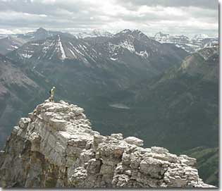
Galwey Ridge
|
| |
|