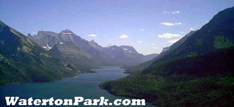
Skiing in Waterton Lakes National Park
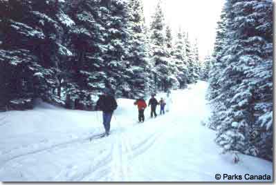 |
Depending on snow
conditions, excellent opportunities for ski
touring may exist on or off the park's trail
system. Popular trails include Crandell Lake
(easy-moderate), Rowe Trail, Akamina Pass,
Summit Lake and Wall/Forum Lakes (all
difficult). These trails are not marked or
maintained and may be subject to avalanche
hazard. Groups ski touring in the backcountry
should carry avalanche beacons, have a
knowledge of avalanche conditions and route
evaluation, and be capable of
self-rescue. |
Ski trails in Waterton Park are categorized as designated
and non-designated. Designated trails are identified by
trailhead signs describing the degree of difficulty and
other trail information. Track setting is carried out for
weekend skiing. Skiers traveling off designated trails are
advised to voluntarily self-register their activity at the
Warden Office.
Voluntary self-registration is available at the Warden
Office to anyone undertaking what they consider to be a hazardous
activity. Registration is provided to ensure your safe
completion of an activity. Once registered you must check in
at the completion of your activity.
Detailed avalanche forecasts and information regarding
backcountry skiing conditions are available by contacting a
warden (859-2224) or by telephoning the Canadian Avalanche
Association (1-800-667-1105). Please see Hazardous
Activity Registration.
Ski Trails in Waterton Park
Cameron Ski Trail (designated)
Length: 5.0 km / 3.1 mi (round trip)
Trailhead: Little Prairie Picnic Shelter on Akamina
Parkway
Description: This easy trail from Little Prairie
Picnic Shelter to Cameron
Lake is wide and flat, and on Akamina Parkway. Travel
through a coniferous forest to a beautiful Cirque Basin
(Cameron Lake), carved out by glacial ice and snow.
Dipper Ski Trail (designated)
Length: 5.5 km / 3.4 mi (round trip)
Trailhead: Rowe Trailhead on Akamina
Parkway
Description: Following babbling Cameron Creek,
this moderately difficult trail is a real wilderness
experience! You will meander through wooded slopes, gliding
over knolls and dips on this single width track. Your ski
starts across from Rowe Trailhead and ends at the Little
Prairie Picnic Shelter, or continue your adventure all the
way to Cameron Lake!
Crandell Lake (undesignated)
Length: 1.6 km / 1.0 mi (round trip)
Trailhead: Crandell Lake Trailhead on Akamina
Parkway
Description: Moderately Easy short trip to
beautiful Crandell Lake.
Rowe Trail (undesignated)
Length: 10.4 km / 6.5 mi (round trip)
Trailhead: Rowe Trailhead on Akamina
Parkway
Description: A difficult trail to Rowe Meadow. It
is possible to visit Lower Rowe Lake prior to the meadow, or
to continue beyond and visit Upper Rowe Lake. This is a
natural trail and Skiers are advised to wear PIEPS
and check Avalanche conditions.
Akamina Pass to British Columbia (undesignated)
Length: 3.2 km / 2.0 mi (round trip)
Trailhead: 14.4 km on the Akamina
Parkway
Description: This moderately difficult trail takes
you on a scenic tour into British Columbia. Skiers can
continue to Wall Lake, Forum Lake, and/or further into
British Columbia. This is a natural trail and Skiers are
advised to wear PIEPS and check
Avalanche conditions.
Summit Lake (undesignated)
Length: 8.0 km / 4.9 mi (round trip)
Trailhead: East of the Lakeshore Parking Area at Cameron
Lake where the bridge spans Cameron Creek
Description: A difficult trail leading you to Summit
Lake. This is a natural trail and Skiers are advised to
wear PIEPS and check Avalanche
conditions.
Important Note: Hazards
When traveling across lakes, please
proceed with caution due to varying ice
conditions. Also, please be wary of avalanche
conditions, particularly on the far side of
Lower Rowe Lake and Cameron Lake.
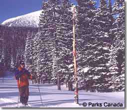
Avalanche Beacons (PIEPS)
When traveling natural trails, it is
important that you equip yourself with an
Avalanche Beacon. In the event of an
avalanche, these will expedite the search and
rescue process, saving crucial time. |
 |
|